
Walk Derry Township Streets by Address
A street-by-street search in Derry Township begins with a property, not a resident roster. The county assessment system can turn a house number and street name into a parcel and a listed owner. The parcel map then adds geographic context, while a Recorder search supplies the document trail. The steps narrow the chance of mixing up similarly named owners or nearby parcels. A voter record is a separate, controlled election-record channel, not an open way to publish names from a street.
- Open the Dauphin County Property Tax Inquiry and search the house number and street name. Select 24 – DERRY TWP when a municipal limit is needed.
- Record the parcel number, site address, listed owner, sale reference, and legal description shown for the matched property.
- Open the Dauphin County Parcel Viewer to see the parcel in its street setting. Treat the map as a reference display, not a survey.
- Use the parcel identifier or parties from the property card in the Recorder index. Check document dates and the legal description before following a transfer.
- For a historical household question, pair the property trail with the Derry Township tax rolls and local archives rather than assuming a current owner lived there.
That order keeps the Derry Township street directory tied to the strongest identifier available. It also leaves room for a deed that uses a lot, block, or boundary description instead of a modern street address.
Derry Township Street Directory Search Fields
The county’s property form is the practical first stop for a Derry Township address. It requires at least one criterion. The form advises a simple address searcher to omit a direction and suffix from the street name, and it permits a parcel number with or without dashes. Owner and address searches describe the assessment record, so match the parcel before drawing any conclusion from an owner or mailing field.
| County field | Use in a street search | Format or limit |
|---|---|---|
| Parcel Number | Identifies one property | One criterion is required; dashes are optional. |
| Owner Name | Confirms a listed owner | Use the last name as it appears on the tax bill. |
| House Number Low / High | Sets an address range | Use with Street Name for a street segment. |
| Street Name | Finds the street portion | Omit direction and suffix in a simple search. |
| Townships/Municipalities | Narrows the result | Select 24 – DERRY TWP. |
| Neighborhoods | Refines an area | The menu includes Central Hershey, South Point, West Hershey, and other Derry choices. |
| Sale date or price | Filters sale records | Use the displayed date range and numeric limits. |
The same form also offers construction-year, square-footage, building-type, and property-class criteria. Those fields can narrow a Derry Township street search, but they are assessment attributes, not proof of a property’s exact construction history or current household.
Note: The county’s electronic property card separates the site address from the owner’s mailing address, which may be somewhere else.
Map a Derry Township Street Parcel
The Parcel Viewer is the map handoff after a Derry Township property match. Its controls include Map Search, Search for Parcel, Parcel Search, Property Info, Tax Assessment, Recorder of Deeds, and Open Data. Parcel Search uses an exact Parcel ID format, while Map Search accepts the beginning of an ID. Point, rectangle, and polygon selections can help a researcher see the parcel pattern on a street, but the County describes its mapping as a representation of legal information and disclaims legal or positional certainty.
- Parcel
- A county-defined piece of land represented in assessment and map records. It is more stable than a casual description of a house on a street.
- Situs address
- The physical location shown for the parcel. It can differ from the owner’s mailing address.
- Legal description
- The deed’s land identity, often using lots, boundaries, or other wording. It helps connect older records that lack a modern street address.
- Criss-cross directory
- A directory arranged by street number rather than by surname. No verified Derry Township run was identified online, so archival holdings must be checked before relying on one.
Historic imagery choices shown in the viewer configuration include 2003 through 2025 selections. They can help date visible changes around a Derry Township street, but they cannot identify a household or establish legal boundaries.
Derry Township Street Record Coverage
Address records overlap without becoming the same thing. The table below separates the records that can be connected to a Derry Township street. Start with the county record that identifies the parcel, then use the appropriate custodian for the next question. This prevents a tax owner, an old deed party, or a permit applicant from being presented as a current occupant.
| Address-keyed record | Custodian | What it can establish | Access route |
|---|---|---|---|
| Property / assessment record | Dauphin County Tax Assessment | Listed owner, site and mailing fields, value, deed reference, and property details | Property Tax Inquiry, counter, or limited owner phone route |
| Parcel map | Dauphin County GIS | Parcel geography and handoffs to assessment and Recorder records | Public Parcel Viewer, updated weekly as a reference map |
| Recorded deed or mortgage | Dauphin County Recorder of Deeds | Parties, record date, document type, legal description, and transfer trail | AcclaimWeb or the Recorder counter |
| Permit or zoning material | Derry Township Community Development | Property-specific project, planning, or code context | Narrow request through the Township or its RTKL channel |
| Election street list | Election authorities | Statutorily controlled registration information | Request only under 25 Pa.C.S. §§ 1207 and 1404 conditions |
| Historic assessment roll | Pennsylvania State Archives | Freeholder, tenant, or annual-occupation entry for a documented period | State Archives research room or selected FamilySearch access |
The state voter-status tool is for an individual’s status and polling place. A public-information, street, or walking list is a controlled request route. Pennsylvania law requires identification and a written statement that the data will not be used for purposes unrelated to elections, political activities, or law enforcement. That distinction matters when researching a Derry Township street.
Derry Township Deeds by Address
Once the property record supplies a party name, deed reference, or parcel identifier, use the Dauphin County Recorder AcclaimWeb search to follow recorded documents. The public site asks visitors to accept its conditions and offers Simple Search, Name, Instrument Number, Document Type, Book/Page, Record Date, Consideration, UPI Number, Municipality/Comments, and Alpha Index modes. County information states deeds and miscellaneous documents run from 1785 to the present, and mortgages from 1979 to the present. Ask the Recorder about a particular early image or index when the web result does not answer the question.
The Recorder simple-search screen is a starting interface for a Derry Township street directory deed check.
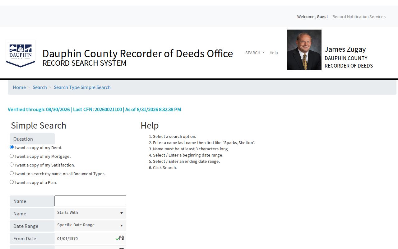
Use a simple result only to form a more precise document or party query, then compare its recording details with the parcel’s legal description.
The Recorder name-search screen shows the name route used after a property card identifies a recorded party.
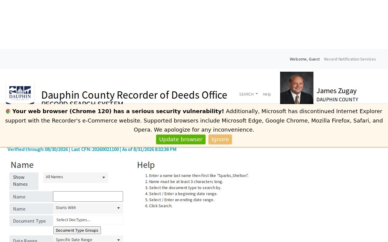
Name help calls for a last-name, first-name form and a minimum of three characters, which makes a precise spelling useful before following a transfer.
The Recorder document-type search narrows a Derry Township address trail by the kind of recorded instrument.
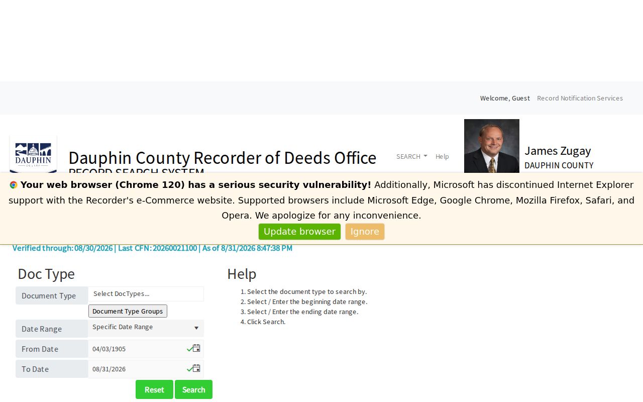
Pair a document type with a recorded-date range or consideration amount only when the property record supplies a reason to use those limits.
The municipality and comments search provides another way to narrow a Derry Township Recorder query.
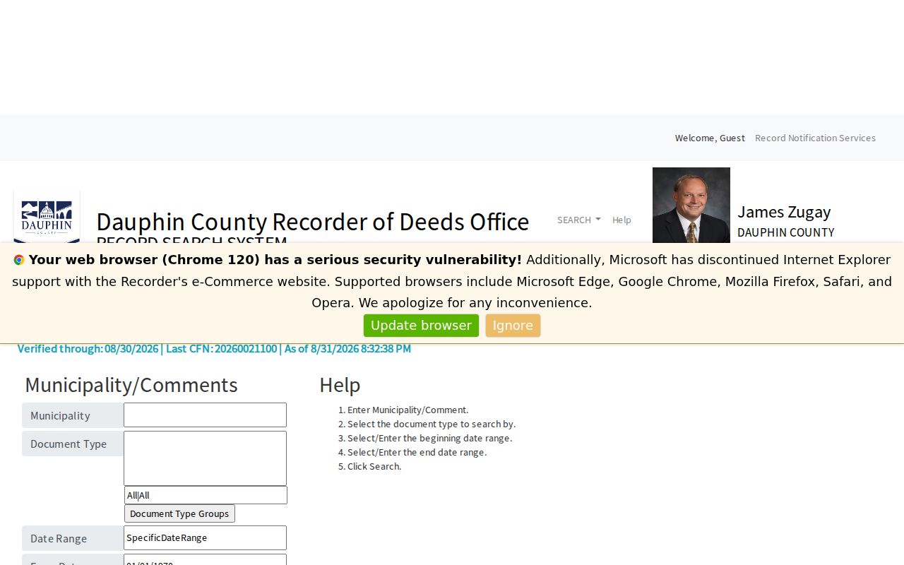
A municipality filter can reduce noise, yet a deed’s legal description and prior reference remain the safer link between documents for the same parcel.
Derry Township Street Postal Names
A Hershey, Hummelstown, or Palmyra mailing label does not settle the municipal jurisdiction for a Derry Township street record. Township material recognizes the 17033, 17036, and 17078 postal areas, while the County property record provides the municipality field needed for a local parcel search. Check that field before assuming a nearby postal city identifies the record keeper.
The mismatch is especially important for deed and permit research. A mailing city is part of an address display layer. The parcel number and legal description are the stronger links when names, postal labels, or road descriptions change across records.
Derry Township Street Permit Requests
Derry Township Community Development holds building, zoning, planning, code, maintenance, and stormwater material. Its public permit paths include building, demolition, zoning, sign, road-occupancy, and sewage matters. The research did not locate a public online address-search database for these files. A street researcher should make a narrow request with the parcel or street, project type, and date range instead of assuming a missing web result means no file exists.
The Township’s Right-to-Know route is the documented fallback for Township-held public records. Pennsylvania’s Right-to-Know Law, Act 3 of 2008, 65 P.S. §§ 67.101-67.3104, governs that channel. Permit records can document a project or approval sequence; they do not establish who lived at the address.
Note: A focused request helps staff locate an existing property file without turning an address inquiry into an overly broad records demand.
Recorded Alerts for Derry Township Streets
The Recorder’s Record Notification Service is a timely monitoring option after a Derry Township property or parcel is identified. It sends email alerts when a document is recorded against a name, property, or parcel number. The service can flag a new filing for review, but it does not certify title, prevent fraud, or replace reading the recorded document and confirming details with the Recorder.
The Recorder notification enrollment page shows the service used for a Derry Township street directory alert.
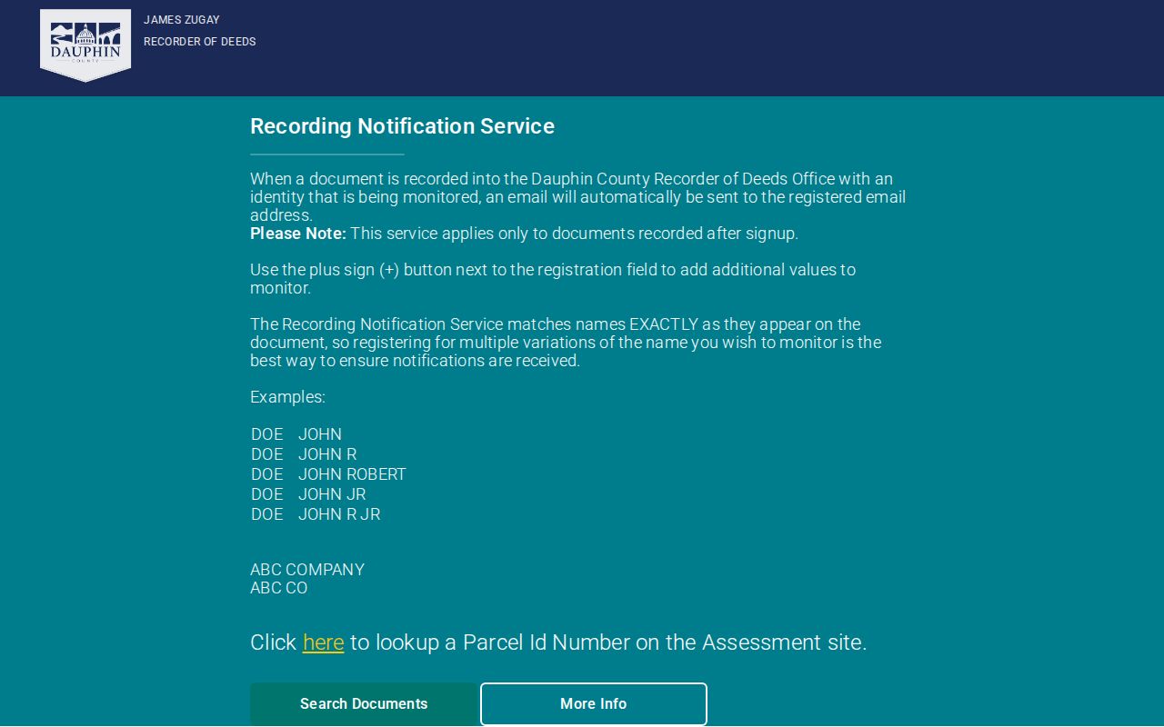
An alert is best treated as a prompt to open the related index entry, check the parcel and parties, and obtain a custodian copy when one is needed.
Historic Derry Township Street Evidence
For an older Derry Township street, the most specific verified address-related historical source is not a confirmed online criss-cross directory. The Pennsylvania State Archives identifies Township assessment records from 1901 through 1952, including freeholder, tenant, and annual-occupation series. Those lists may preserve a person’s listed status when a deed chain leaves out a tenant. They are not a full census of every person in a house.
The Hershey History Center is another local route for deeds, maps, newspapers, family files, obituaries, oral histories, and related material. Its collections are available by appointment. The separate Derry Township city directory resources explain the historical collection side in greater depth; for a street question, use those sources to test one parcel trail rather than build an unverified street roster.
Derry became part of Dauphin County in 1785 after earlier boundary changes. That history helps explain why the Recorder’s early county coverage and older archives may need to be used together for the oldest property trail.
Derry Township Street Directory Limits
A Derry Township street directory can identify public property records and their source paths. It cannot reliably show every renter, visitor, utility customer, delivery recipient, or current household member. DMV address information is protected, address-confidentiality participants may use a substitute address, and owner or tax-mailing fields can be delayed, corporate, trust-held, vacant, or off-site. A property name is evidence about the record, not a claim about a person’s present residence.
Lawful use. Use Derry Township address records for personal, family-history, property, civic, or estate research. Do not use an address trail to stalk, harass, intimidate, or harm anyone.
When a record matters, confirm it with the office that holds it. That may mean the Assessment counter, the Recorder counter, the Township’s Open Records Officer, or the State Archives research room rather than a search result alone.